Romincka Forest
Romincka Forest is a huge forest, spread over an area of several hundred square kilometers, now divided by a border, but was once a single whole. Forestry in Romincka Forest has been well organized since the ducal times. For the convenience of orientation and movement through the forest, the entire massif was divided by clearings into quarters and plots, roads were laid here, and signs were installed for orientation.
The cutting of forests into special forest plots-corrals began in Pushcha as early as the 16th century. These plots were formed by a rectangular grid of clearings. Each plot had an area of 50 to 100 hectares. They had to be cleared of "warehouse timber", i.e. of fallen trees, to allow large game to move freely and escape from large predators. In the clearings cleared of grass, it was possible to find animal tracks and draw conclusions about the presence of wild animals. But they served primarily as corrals for animals during hunting. In the 18th century, these corrals were divided and renamed into blocks, corrals and logging areas-plots. Thus, the foundation for developing forestry was laid.
Forest paddocks (Jagen)
Forest enclosures for game, which replaced forest plots in the 18th century, were rectangular forest plots of 50 to 100 hectares in size, formed by clearings. They were continuously numbered. Enclosures were combined into quarters (Blöcke), which in turn formed forest plots (Beläufen).
Forest Quarters (Blöcke)
The basic unit of forest management since the 18th century. Quarters were designated by capital letters. For example, in 1780, the Nassaven forest area had 11 quarters, which coincided with sub-sections. Quarters A, B, C, D, E, F, G, and H were in turn divided into 70 consecutively numbered plots.
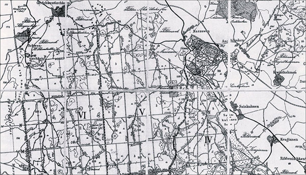
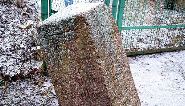
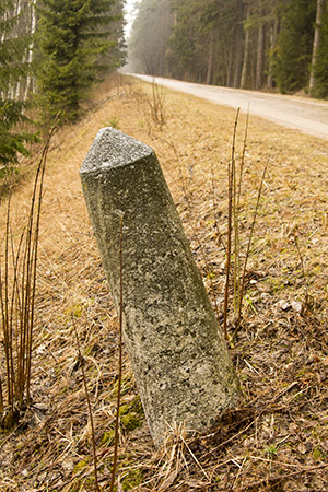
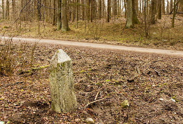
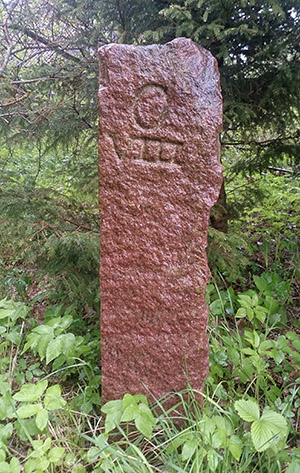
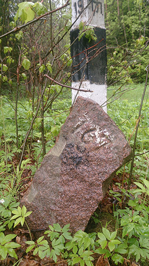
Ultimately, at the turn of the 19th and 20th centuries, the entire territory of the Pushcha was divided into forest quarters. This was done to make it easier to navigate in the forest. The entire forest was divided by straight clearings into square sections – quarters, approximately 800×800 meters in size. Each of them had its own number until 1945, as it still does today. In places where clearings and quarter roads begin, as well as at their intersections, you can still find old hewn stones with letters and numbers carved on them – Jagenstein (quarter stones). A pair of quarter posts were installed at the intersection of clearings, which designated the main and additional clearings. For example, at the intersection of clearings D and d (corrals 27/28/39/40), on the southern side of clearing D and to the west of clearing d, a stone with numbers 27/28 was installed, and on the northern side of clearing D and to the east of clearing d, a stone with numbers 39/40.
The clearings crossing the Pushcha horizontally were designated with capital Latin letters, while the vertical ones were designated with small letters. The designation went from bottom to top and from right to left, respectively.
It should be noted that a similar system operated throughout the entire territory of Prussia.

And today these stones help scientists and researchers to orient themselves in the area, since German sources and scientific publications indicate precisely the enclosures or quarters as the most accurate marks of the places where rare species of trees and plants grow, the location of memorial stones, burial sites, etc. The numbering of the quarters went from right to left and from bottom to top, and each of the four forestries had its own numbering, starting with 01. But the two neighboring forestries of Rominten and Warnen had a common numbering.
So, when indicating the location of a memorial stone in honor of the 40th hunting anniversary:
Rominten Forestry District, Fuchsweg Forestry District, Enclosure 93 – Rominten Forestry District, Fuchsweg Forestry District, Enclosure 93.
The quarter roads and clearings that crossed the forest and divided the forest areas had their own names, for example, Hirsch Weg (Weg – path, track) or Friedrich-Carl Gestell (Gestell – clearing). The central roads were called “streets” and also had their own names, for example, the central road to the Imperial hunting lodge was called Jagdbuder Strasse, and the road to Goldap was called Goldaper Strasse.
Road signs
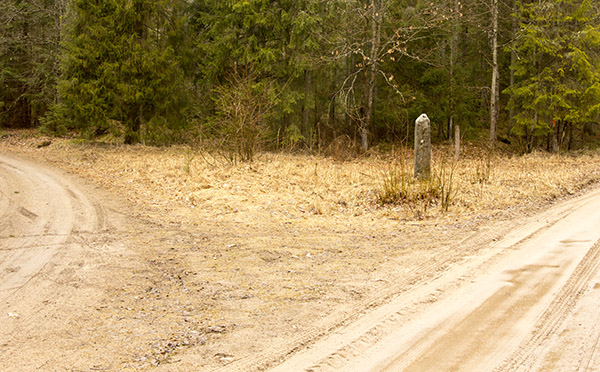
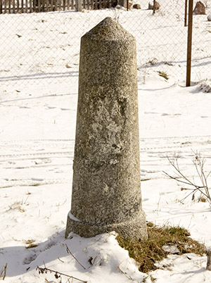
In some areas and at the intersections of roads in Pushcha, you can still find marker stones - hewn pillars with four sides, with carved arrows indicating the direction. The distance to the main settlements is also indicated. The names of the settlements, applied to the marker stones, indicate that some of these stones were installed back in the 18th century.
For example, on a signpost on the outskirts of the village of Chistye Prudy, at a fork in the road, there is an inscription with arrows:
Our gold app is 3 miles away/Our pills are 3 miles away
Our gold app is 3 miles away*
(To Goldap via Ishlaudsen 3 miles / to Pilluponen 3 miles. To Goldap via Varnen 3 miles)
True, on most of the stones the inscriptions are already barely visible or have been completely erased by the merciless time.
Signposts preserved in Romintskaya Pushcha and the surrounding area (on the
Russian side):
- in the center of the settlement of Pugachevo, no inscription;
- at the fork in the road in the settlement of Chistye Prudy, the inscription is
legible;
- at the fork in the roads of Krasnolesye, Pugachevo, Raduzhnoye, the
inscription is erased, arrows are visible;
- at the fork in the roads of Dmitrievka, Raduzhnoye, Sosnovka, no inscription;
- near the road Lesistoye - Raduzhnoye, at the fork on the left, the inscription
is difficult to read;
- near the road Uvarovo - Lesistoye, on the side of the road on the left;
- at the fork in the road near the cemetery of the settlement of Pugachevo, no
inscription.
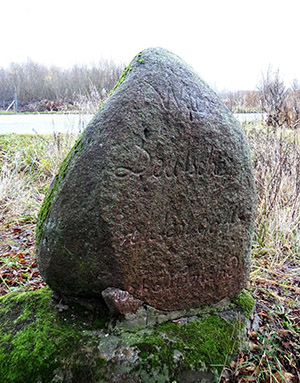
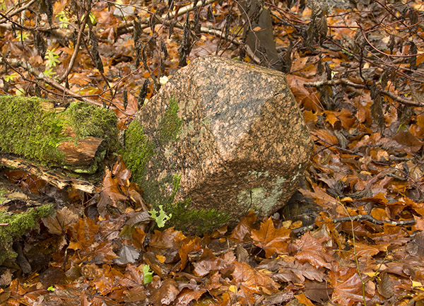
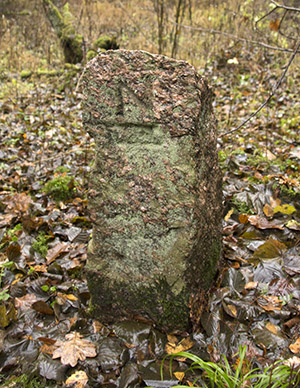
The so-called boundary or border stones are worth mentioning separately. Such stones were usually installed by the roads, marking the place of the border between the plots of different estates, manors and settlements. You can see two such stones in Pushcha on the Russian side and one on the Polish side. This is the stone on the right by the Krasnolesye - Chistye Prudy road, of a very unusual shape, marking the borders of the Samonien/Dokuchaevo estate. Another similar stone, brought from the Ozerki settlement area, was installed on the territory of the Vishtynetsky Ecomuseum in Krasnolesye. The stone has poorly legible remains of the inscription "... Gut ...gken". And the stone on the left by the Gołdap - Dubeninki road, near Lake Ostruvek, marking the borders of the lands of the former Gehlwiden/Galwece estate.
Nowadays, some of the clearings and forest roads are not used, the quarter stones are covered with moss and overgrown with grass and bushes, but they still fulfill their purpose, so the author of these lines has had to use the German designation system more than once in search of memorial stones and glacial boulders, and the preserved quarter stones are of great help in this.
* Distances were given in Prussian miles. One Prussian mile was equal to 7.533 km.
Sources:
Gautschi A. Rominten 1500 to 1945: An alphabetical list. Newman-Neudamm Melsungen, 2009.
Rothe W. Dörfer der Rominter Heide. — Prussia-Reihe, 2004.
Archive of the Vishtynetsky Ecological and Historical Museum.
Topographic maps scale 1:25000