Maps of the Third Reich
Maps of Germany during the Third Reich, created by the American Office of Strategic Services (OSS), the intelligence agency that became the forerunner of the CIA.
The maps themselves reflect the knowledge that US intelligence agencies had about their enemy during World War II.
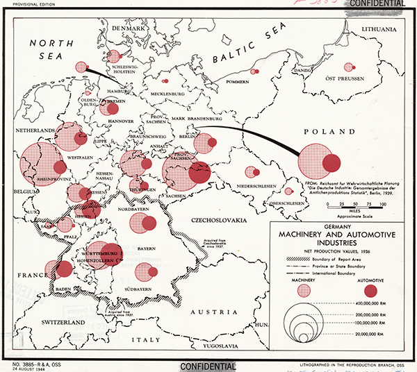
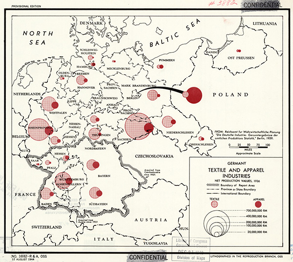
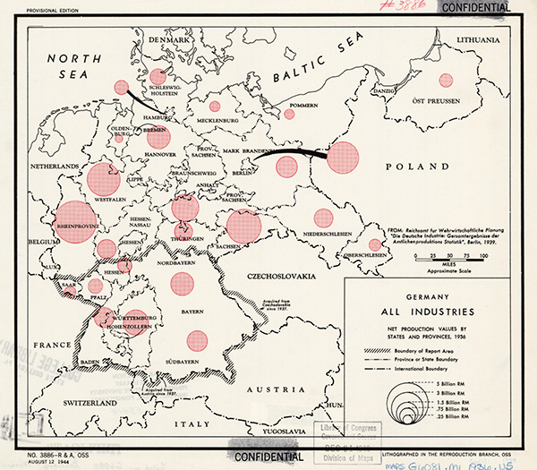
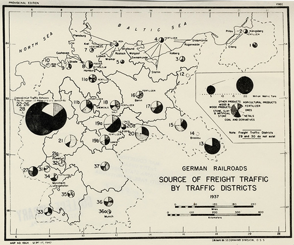
It is obvious that all cartographic information is very conditional and cannot claim to be super-objective. The sources of information were official statistical data published by the Reich Statistics Office. The statistical data were taken as of 1936. It is clear that Germany had significantly increased its economic and production potential by the beginning of World War II. Let us not forget that by the beginning of the war there had already been both the Anschluss and the Munich Agreement. And then the occupation of half of Europe. Nevertheless, the maps are of a certain interest.
In particular, maps of the Third Reich's economy before the war clearly indicate that East Prussia was not a region of any industrial significance for Germany.
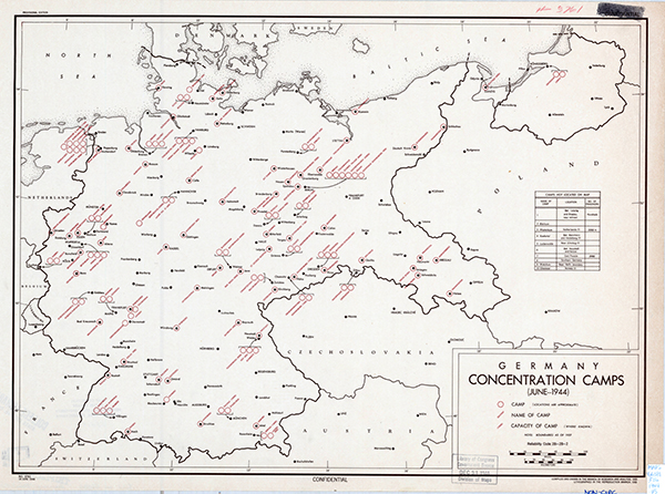
Map of concentration camps in Germany as of June 1944. Modern researchers claim that even in the early summer of 1944, just a year before the fall of the Nazi regime, the Allied secret services had only a vague idea of what was really going on in German concentration camps. There was an understanding that there were special camps for Jews, but the secret services generally had no reliable information about the systematic extermination of people taking place in these camps.
Source:
Penn State University